Showing most recent first, in descending order
2 images in cluster Bridge end Inn in Bedwas in ST1688
Image clustering - assigning images labels - is an automated process, based on the image title/description. It's not totally accurate, and can sometimes assign images to odd clusters
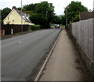
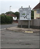
in ST1688, near Bedwas, taken Wednesday, 19 June, 2019, by Jaggery
Explore these images in the Browser or Explore matching images including in surrounding squares (if any!)
All images  © Jaggery and licensed for reuse under this Creative Commons Licence
Other Automatic clusters in ST1688
- Bedwas House Industrial Estate
- Pandy Road
- Parc Pontypandy
- Old Bedwas Road
- Unit
- Sir Stafford Close
- Located in Bedwas House Industrial Estate
- Rudry Road
- Crossways Retail Park
- Gallagher Retail Park
- Parc Avenue
- Premier
- Porset Farm
- West of Church Street
- Ground of Bedwas RFC Rugby Football Club
- Fishermans Rest
- Near the Corner
- Electricity Substation
- Tesco
- Entrance Gates
- St Christopher's Close
- Combined Footpath and Cycleway
- Unnamed Ring Road Skirting the Eastern Edge
- Venture Wales
- Saron Chapel
- Fenced-off Shell of a former Pizza Hut
- Nant Yr
- Car Park
- Records that the Bridge
- King George
- Trap Well is a Residential Cul-de-sac
- Greenway Workshops
- Telecoms Cabinet
- Part of Bedwas House Industrial Estate
- Grassy Roundabout
- Single-storey Building
- Lon Yr Ysgol