Showing most recent first, in descending order
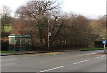
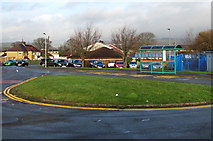
2 images in cluster Bus Stop and Shelter in ST1095
Image clustering - assigning images labels - is an automated process, based on the image title/description. It's not totally accurate, and can sometimes assign images to odd clusters
in ST1095, near Abercynon, by Jaggery
When: 22 December, 2018
When: 17 December, 2018
Explore these images in the Browser or Explore matching images including in surrounding squares (if any!)
All images  © Jaggery and licensed for reuse under this Creative Commons Licence
Other Automatic clusters in ST1095
- A472 Mafon Road
- Near Nelson
- Pentwyn Road
- Hollybush
- South side of High Street
- Western end of High Street
- Approach to Nelson
- Community Centre
- Western Edge of Nelson
- Heol Islwyn
- Bungalows
- Llanfabon Road
- Junction
- Road Named Bryncelyn
- Hollybush Pub
- Allotments
- East side of Llwyncelyn Terrace
- Heol Tasker
- Dark Green
- Electricity Substation
- Ynys
- Heol Morien
- Bus Stop and Shelter
- Welsh Water
- Trafalgar Park
- Mound at the SW Edge of Nelson
- Direction Sign
- Queen Elizabeth II Postbox
- Zigzag Yellow Markings