Showing most recent first, in descending order
7 images in cluster Carries Avenue Road in TQ2783
Image clustering - assigning images labels - is an automated process, based on the image title/description. It's not totally accurate, and can sometimes assign images to odd clusters
in TQ2783, near Camden Town
Explore these images in the Browser or Explore matching images including in surrounding squares (if any!)
Other Automatic clusters in TQ2783
- Primrose Hill
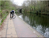
- Canal at Regent's Park
- John's Wood
- London Zoo
- Bridge on Regent's Canal
- Prince Albert Road
- View from Primrose Hill
- Charlbert Street
- Avenue Road
- Outer Circle
- Near
- Path
- Top of the Hill
- Snowdon Aviary
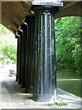
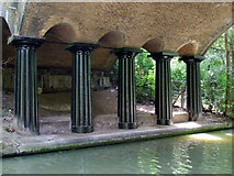
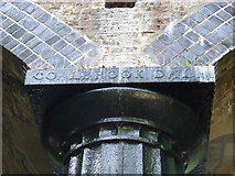
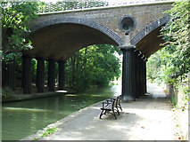
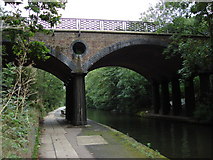
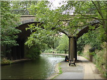
- Macclesfield Bridge
- Grand Union Canal
- Primrose Hill NW1
- Area
- Details
- Footbridge
- Penfold
- Looking North-northeast
- Trees
- John's Wood Terrace
- BT Tower
- Towpath
- Houses on the Outer Circle
- Cast Iron Columns
- Hub Pavilion
- Belsize Park Estate Owners in Obtaining Permission
- Area from Primrose Hill
- Carries Avenue Road
- London Skyline
- Grand House
- Mackennal Street
- Wellington Place
- Path Leads
- Details about the Building
- Victorian Postbox
- Sign
- Giraffe
- Wood Carvings
- View Taken
- Large Number
- BT Tower can be Seen
- Cast Iron Columns Supporting the Macclesfield Bridge
- Pair of Grade II Semi-detached Villas
- Sports Pavilion
- Edmund's Terrace
- Eamont Street
- Mappin Terraces
- North West
- Telephone Boxes
- Blue Plaque
- Public House
- New Viewing Platform to the East
- Stunning 360 Degree View of the Heart
- NW8 21
- Allitsen Rd
- Prince Albert Rd