Showing most recent first, in descending order
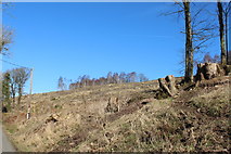
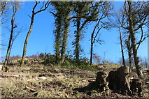
2 images in cluster Cleared Woodland Near Greenheights in NX4564
Image clustering - assigning images labels - is an automated process, based on the image title/description. It's not totally accurate, and can sometimes assign images to odd clusters
in NX4564, near Stronord, taken Monday, 14 March, 2016, by Billy McCrorie
Explore these images in the Browser or Explore matching images including in surrounding squares (if any!)
All images  © Billy McCrorie and licensed for reuse under this Creative Commons Licence
Other Automatic clusters in NX4564
- Kirroughtree Trail
- Car Park
- Kirroughtree Forest
- Miles South of Newton Stewart
- Visitor Centre Car Park
- Road from the Visitor Centre
- National Cycle Route
- Wildlife Hide
- Bridge over Bruntis Burn
- Path
- Big Wheel
- Old Bridge of Palnure
- Track
- Kirroughtree Skills
- Approaching
- Marker Post
- Woodland
- Looking
- Signs
- Cairnsmore of Fleet
- Leading to the Visitor Centre
- Nutkin Cottage
- Visitor Centres in the Galloway Forest Park
- Outdoor
- Kirroughtree Skills Area
- Exit Road from Kirroughtree Visitor Centre
- Crossroads at Stronord
- Bruntis Loch
- Mountain Bike
- Picnic Area
- Farmland
- Old Ruin
- Minor Road
- Curchiehill Wood
- Holiday
- New Exit Road from Kirroughtree
- Anniversary Cairn Trail
- Approaching Stronord
- Viewing Platform
- Kids Play Area
- 7stanes Cycle Route
- Trail to the Bird Hide at Kirroughtree
- Cleared Woodland Near Greenheights
- Seat on the Wild Watch Trail
- View from the Wildlife Hide
- Royal Engineers
- Autumn
- Exit Entry Road
- Gift Shop