Showing most recent first, in descending order
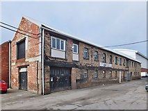
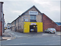
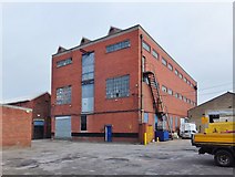
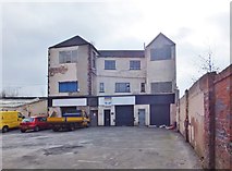
5 images in cluster Developed by Thomas English in TA0827
Image clustering - assigning images labels - is an automated process, based on the image title/description. It's not totally accurate, and can sometimes assign images to odd clusters
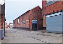
in TA0827, near Kingston upon Hull, taken Thursday, 6 March, 2014, by Bernard Sharp
Explore these images in the Browser or Explore matching images including in surrounding squares (if any!)
All images  © Bernard Sharp and licensed for reuse under this Creative Commons Licence
Other Automatic clusters in TA0827
- Kingston upon Hull
- William Wright Dock
- Albert Dock
- Street and Hessle Road
- Path
- English Street
- Boulevard and Hessle Road
- Goulton Street
- Hessle Road Junction
- Clive Sullivan Way
- Smith Nephew
- Shop
- Path Leading to Subway Street
- Junction with the Boulevard
- Premises
- East
- Factory
- Grade II Listed Building
- Trans Pennine Trail
- Crane
- Bench Dedicated
- Trawler
- Madeley Street
- Daltry Street
- River Humber
- Footbridge over the A63
- Humber Estuary
- Memory of the Gallant Crew
- Elliott Chappell Health Centre
- Building on English
- Western Library
- City Temple
- Premier Work
- Situated on Hessle Road
- W. Alfred Gelder
- Developed by Thomas English
- Wassand Arms
- St Mark's Square
- Showing Position of Postbox
- North Sea
- St James Street off English Street
- Situated on the Corner
- Barclays Bank
- Photo Taken Looking
- Hull Training
- Flyover Carries the A63
- Units on Goulton Street
- Designed by William Freeman
- Dockland Dereliction
- No.254 Boulevard
- Footpath Near Albert Dock
- Neptune House
- Riverside Quay
- Edmund House
- Fuel at William Wright Dock
- Fishing Heritage
- Gallant Crew of the St Romanus
- Strickland St
- Albert Leake
- Depicted is the Stretch of Footpath
- Criterion Hotel
- Corner of Coltman St
- Truncated Remains of former Ropery