Showing most recent first, in descending order
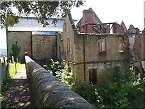
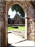
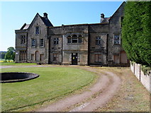
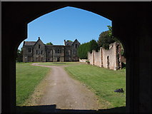
5 images in cluster Dilapidated Annesley Hall in SK5052
Image clustering - assigning images labels - is an automated process, based on the image title/description. It's not totally accurate, and can sometimes assign images to odd clusters
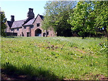
in SK5052, near Annesley/SK5053, taken Saturday, 26 May, 2012, by David Hallam-Jones
Explore these images in the Browser or Explore matching images including in surrounding squares (if any!)
All images  © David Hallam-Jones and licensed for reuse under this Creative Commons Licence
Other Automatic clusters in SK5052
- NG15 Annesley Hall Area
- Chaworth-Musters Family
- Mansfield Road A608
- Sherwood Business Park
- Stable Block
- Annesley Old Church
- Grade I-listed former Annesley Church
- Near
- Dilapidated Annesley Hall
- Saints
- Stone Steps
- Derelict
- Hotel
- Bear Lane
- Sorry State as the Result of Fires
- Roundabout
- RAF Stirling Memorial
- Passing
- Office
- Extremely Extensive Agricultural Land that Local Farmers
- Weavers Lane