Showing most recent first, in descending order
2 images in cluster Earlier Views in SK5641
Image clustering - assigning images labels - is an automated process, based on the image title/description. It's not totally accurate, and can sometimes assign images to odd clusters
in SK5641, near Nottingham/SK5641, by John Sutton
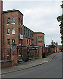
When: 7 September, 2016
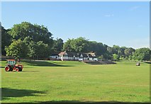
When: 5 September, 2013
Explore these images in the Browser or Explore matching images including in surrounding squares (if any!)
All images  © John Sutton and licensed for reuse under this Creative Commons Licence
Other Automatic clusters in SK5641
- Forest Fields
- Forest Recreation Ground
- Church Cemetery
- Sherwood Rise
- Goose Fair
- Benchmark on Wall
- Gregory Boulevard
- Entrance to Forest
- Stanley Road
- High Pavement Grammar School
- Berridge Road
- Forest Fields Primary School
- Built as Nottingham
- Watson Fothergill
- Noel Street
- Seen
- Ordnance Survey Cut Mark Benchmark Described
- Avenue and Sherwood Rise
- Date
- Forest Tram Stop
- Mount
- Wiverton Road
- Foxhall Road
- Gladstone Street
- Hyson Green
- New Building
- City Centre
- Rides at the Fair
- Beech Avenue
- Refurbished as a Primary School in 2013
- Alberta Terrace
- Corner Shop
- Soft Sandstone
- Mansfield Rd
- Park and Ride
- Boundary Marker
- Victorian Architect
- Grand Villas
- Polish Church
- Pair of Houses
- Cross Gregory Boulevard
- Bright September Morning
- Annual Goose Fair
- Football Field
- Southbound Tram
- Restored Windows
- East Midlands
- Looking East
- NG5 Mansfield Rd
- John Farr Rest Garden
- Looking West
- Like much of the Area
- Bulwell Stone
- Caves were later put to other Uses
- Community had Swollen to 500 Families
- Roundabout at the Junction
- St Ann's Valley
- Grammar-school Days
- Trafalgar Lodge
- Bonfire with Old Pallets while Showmen Prepare
- Early Part of the Twentieth Century
- Giving Details of the Inclosure Oak