Showing most recent first, in descending order
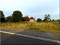
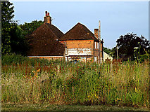
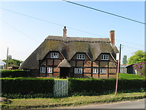
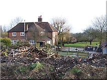
4 images in cluster Farmhouse in SU3715
Image clustering - assigning images labels - is an automated process, based on the image title/description. It's not totally accurate, and can sometimes assign images to odd clusters
Explore these images in the Browser or Explore matching images including in surrounding squares (if any!)
Other Automatic clusters in SU3715
- Adanac Drive
- Adanac Park Off Adanac Drive
- Entrance
- Explorer House
- Ordnance Survey Headquarters
- Redbridge Lane
- Yew Tree
- Ordnance Survey Head Office
- Looking
- Brownhill Way
- Junction with Frogmore Lane
- Fields
- Car Park
- New OS HQ
- Edge
- Construction
- Years
- Brick Wall
- Yew Tree Farm
- Plaque
- Jerrett's Lane
- Acoustic Barrier to the Adjacent Motorway Noise
- Grid References
- Small
- Holiday Inn Express Hotel
- Southampton West
- Stream Running through Home Covert Woods
- Roundabout Near
- Logo
- Water Feature
- Farmhouse
- Hillyfields Village
- Memorial
- Cleared Woodland
- Starts
- New Pub
- Danebury Way
- Nursery
- M271 Motorway
- Venue for the 2014 Geograph Conference
- Broken
- Lidl Depot
- Village Name Sign
- Lord's Hill
- State-of-the-art Headquarters Building
- Planting
- Posts
- Romsey Road