Showing most recent first, in descending order
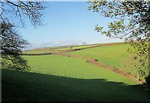
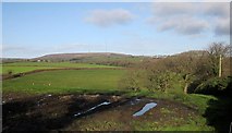
2 images in cluster Farmland in SX2966
Image clustering - assigning images labels - is an automated process, based on the image title/description. It's not totally accurate, and can sometimes assign images to odd clusters
in SX2966, near St Ive, taken Saturday, 13 December, 2014, by Derek Harper
Explore these images in the Browser or Explore matching images including in surrounding squares (if any!)
All images  © Derek Harper and licensed for reuse under this Creative Commons Licence
Other Automatic clusters in SX2966
- Lower Venton
- Public Access Green Lane from Butterdon Farm
- Approaches
- Farmland
- Little Lane
- Continues
- Near Butterdon Farm
- Near Butterdon Mill
- Point
- Bank
- Skelton's Wood