Showing most recent first, in descending order
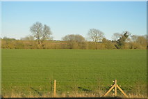
images in cluster Farmland in TL4165
Image clustering - assigning images labels - is an automated process, based on the image title/description. It's not totally accurate, and can sometimes assign images to odd clusters
in TL4165, near Oakington, taken Saturday, 25 March, 2017, by N Chadwick
Explore these images in the Browser or Explore matching images including in surrounding squares (if any!)
All images  © N Chadwick and licensed for reuse under this Creative Commons Licence
Other Automatic clusters in TL4165
- Oakington Stop
- Station Road
- Oakington Airfield
- Cambridge Guided Busway
- Bus
- Northstowe Phase
- Cambridge Railway
- New Town
- Level Crossing
- Junction
- Station Rd
- Sign
- Trees
- Cyclepath
- National Cycle Route 51
- Station Building
- Field
- Phase 3a
- North
- Near
- Pillbox
- Plants
- Oakington Halt
- Old Oakington Station
- Bridleway
- Land
- Southern Access Road
- Westwick Hall
- Hedge
- Blue Tit Mural
- Structure
- Stationmaster's House
- Cambridge-bound Platform
- Early Works
- Fox Covert
- Longhorn Cattle
- Showing Position of Postbox
- Artwork