Showing most recent first, in descending order
images in cluster Field in SE1316
Image clustering - assigning images labels - is an automated process, based on the image title/description. It's not totally accurate, and can sometimes assign images to odd clusters
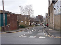
in SE1316, near Huddersfield, taken Tuesday, 2 February, 2016, by Betty Longbottom
Explore these images in the Browser or Explore matching images including in surrounding squares (if any!)
All images  © Betty Longbottom and licensed for reuse under this Creative Commons Licence
Other Automatic clusters in SE1316
- Huddersfield Narrow Canal
- Greenhead Park
- Manchester Road
- Viewed
- St Thomas
- Gledholt
- Springwood
- Huddersfield Narrow Canal towards Lock
- Longroyd Bridge
- Trinity Street
- Market Street
- Railway Viaduct
- River Colne
- Gledholt Bank
- Paddock Foot
- Birkhouse Lane
- Lock 4E
- Public House
- Oastler Avenue
- Shires Hill
- North Crosland
- Lock 5E
- Heaton Road
- Park Drive South
- Penistone Line
- High Street
- Springdale Avenue
- World War Memorial
- Trees
- Ordnance Survey Cut Mark
- Conacher Organ
- Part of the Towpath
- Bridge Hotel
- Bridge Public House
- Bridge 29
- Paddling Pool
- Spring Grove Primary School
- Bus Garage
- Shafts
- Grasmere Road
- Hill Top Road
- Row of Shops