Showing most recent first, in descending order
2 images in cluster Field Lane in SE1321
Image clustering - assigning images labels - is an automated process, based on the image title/description. It's not totally accurate, and can sometimes assign images to odd clusters
in SE1321, near Elland, by Betty Longbottom
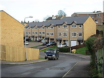
When: 24 December, 2013
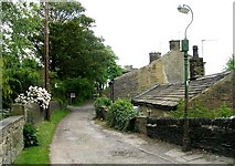
When: 14 May, 2008
Explore these images in the Browser or Explore matching images including in surrounding squares (if any!)
All images  © Betty Longbottom and licensed for reuse under this Creative Commons Licence
Other Automatic clusters in SE1321
- Crowtrees Lane
- Delf Hill
- Carr Green
- Rastrick School
- Looking
- House Built
- Lower Edge Road
- Tofts Grove
- Church Street
- Road was Built
- Ogden Lane
- St Matthew's Church
- Terrace
- Highfield Road
- Entrance
- Jumble Dyke
- Mayster Grove
- Public Footpath
- Small
- William Smith
- Chapel Croft
- Holly Bank
- A643
- Sherburn Road
- Spout Hill
- Field that was Called
- Library
- Play Area
- Anglican and Methodist Church of St Matthew
- Hoods
- Brighouse FP99
- Foxcroft Drive
- Guide Stone
- Garages
- Narrow Part
- Recreation Ground
- Building Work
- New Shop
- Council Estate
- Car Park
- Churchyard of St
- Top of Tofts Grove
- Open Space
- Vicarage Gardens
- Base in the Churchyard
- Castle Avenue
- Malham Avenue
- Surveyed Milestone Society National ID
- Arncliffe Crescent
- Alternative View
- Thornhill Arms
- Shannon Close
- Sandwich Shop
- Cherry Tree
- Corner of Ogden Lane and Victoria Gardens
- Cottage Residential home for the Elderly
- Dormer Bungalows
- Path and Stile
- Junction 13 Miles
- Reins Wood