Showing most recent first, in descending order
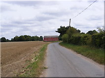
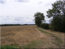
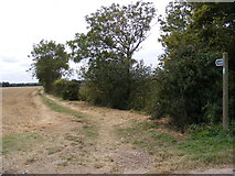
3 images in cluster Footpath to Barell's Hill in TM3275
Image clustering - assigning images labels - is an automated process, based on the image title/description. It's not totally accurate, and can sometimes assign images to odd clusters
in TM3275, near Cratfield, taken Thursday, 18 August, 2011, by Geographer
Explore these images in the Browser or Explore matching images including in surrounding squares (if any!)
All images  © Geographer and licensed for reuse under this Creative Commons Licence
Other Automatic clusters in TM3275
- Mary's Lane Footpath
- Manor Farm
- Barn
- Near to Huntingfield
- Footpath to Manor Farm
- Church Farm Cottage
- Cratfield
- Entrance to Linstead Hall
- Entrance to Lower Hall Farm
- Byway
- Footpaths to the B1123 Harleston Road
- Footpath to Barell's Hill
- Field
- Cookley Green
- West
- Track
- Sign
- Near to the Footpath to Manor Farm
- Barn Taken from Near Four Winds
- Leads
- Yew Tree Cottage