Showing most recent first, in descending order
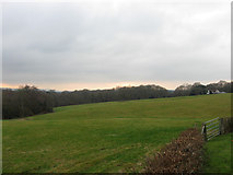
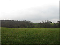
2 images in cluster Gunhill Wood in TQ5615
Image clustering - assigning images labels - is an automated process, based on the image title/description. It's not totally accurate, and can sometimes assign images to odd clusters
in TQ5615, near Gun Hill/TQ5614, taken Sunday, 29 January, 2012, by Simon Carey
Explore these images in the Browser or Explore matching images including in surrounding squares (if any!)
All images  © Simon Carey and licensed for reuse under this Creative Commons Licence
Other Automatic clusters in TQ5615
- Field According to Chiddingly's 1839 Tithe Map
- Barn
- Stonehill Farm
- Junction of Stonehill
- Grade II Listed
- Easterfields Oast
- Slope of Pick Hill
- Farmhouse
- Oast House
- Sign
- Powdering Tub Wood
- Charity Farm
- 15th Century
- Eastern Slope of Stone Hill
- Entrance
- East Sussex
- Forge Wood
- Mill
- Road to Horam
- Sheep
- Chiddingly Rd Junction
- Highdown
- Gunhill Wood