Showing most recent first, in descending order
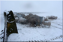
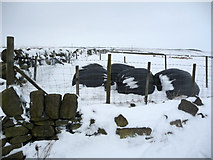
2 images in cluster Haylage in SD9825
Image clustering - assigning images labels - is an automated process, based on the image title/description. It's not totally accurate, and can sometimes assign images to odd clusters
in SD9825, near Hebden Bridge, by Phil Champion
When: 21 February, 2010
When: 10 January, 2010
Explore these images in the Browser or Explore matching images including in surrounding squares (if any!)
All images  © Phil Champion and licensed for reuse under this Creative Commons Licence
Other Automatic clusters in SD9825
- Whittaker Road
- Kilnshaw Lane
- Rake Head
- Lower Rough Head Farm
- Pennine Way
- Bridleway along the Edge of Erringden Moor
- Field
- Near
- Walls
- Track
- Stoodley Pike from Whittaker Road
- Pinnacle Lane
- Top of Whittaker Road
- Public Footpaths
- Kershaw Farm
- Disused Quarry
- Stile
- Horse
- Landcover: Acid grassland
- Line
- Top of Beaumont Clough
- Haylage
- National Trail
- Edge end Plantation