Showing most recent first, in descending order
2 images in cluster Hill in TQ3814
Image clustering - assigning images labels - is an automated process, based on the image title/description. It's not totally accurate, and can sometimes assign images to odd clusters
in TQ3814, near Chiltington
Explore these images in the Browser or Explore matching images including in surrounding squares (if any!)
Other Automatic clusters in TQ3814
- Warningore Wood
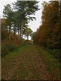
- Footpath
- Field According to the 1842 Tithe Map
- Field According to the 1844 Tithe Map
- East Chiltington
- Acres
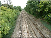
- Railway Line
- Parish Boundary between St John
- Whitehouse Farm
- Distinctive Crown of Blackcap can be Seen
- Beechwood House
- Near Spooners Farm
- Oak Field to the West
- Edge
- Allington Lane
- Tree
- Track
- Stag Oak
- Clay
- Lewes
- Cornered Meadow
- Hill