Showing most recent first, in descending order
images in cluster Horley in TQ2942
Image clustering - assigning images labels - is an automated process, based on the image title/description. It's not totally accurate, and can sometimes assign images to odd clusters
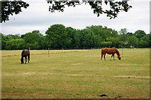
in TQ2942, near Horley/TQ2843, taken Wednesday, 7 July, 2010, by Robin Webster
Explore these images in the Browser or Explore matching images including in surrounding squares (if any!)
All images  © Robin Webster and licensed for reuse under this Creative Commons Licence
Other Automatic clusters in TQ2942
- Harrowsley Green Lane
- Haroldslea Drive
- Balcombe Road
- Bridleway 371
- Footpath 381
- Moats of Thunderfield Castle
- Footpath 373a
- Boundary of the Long Gone Thunderfield Common
- Burstow Stream
- Haroldslea House
- Harrowsley Green Farm and Smallfield Road
- Crossing
- Suburban Footpath
- Start
- Newstead Hall Lodge
- Corner
- Entrance to Thunderfield Moats
- Brighton Historic Commercial Vehicle Run
- Balcombe Rd
- Limes Avenue
- Looking West towards Balcombe Road
- Plantation
- Public Footpath 373a
- Balcombe Gardens
- Field
- Edge of Horley
- Drain Leaving the Moats of Thunderfield Castle
- Downstream
- Curious Entrance off Haroldslea Drive
- Coronet
- Bayhorne Lane
- Woodland South