Showing most recent first, in descending order
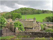
10 images in cluster House in SK2381
Image clustering - assigning images labels - is an automated process, based on the image title/description. It's not totally accurate, and can sometimes assign images to odd clusters
in SK2381, near Hathersage

Explore these images in the Browser or Explore matching images including in surrounding squares (if any!)
Other Automatic clusters in SK2381
- St Michael
- Hathersage Station
- Road in Hathersage
- Hathersage Church
- Railway
- Churchyard
- Hope Valley
- Path
- Approach
- Baulk Lane
- Oddfellows Road
- Memorial
- Little John's Grave
- MILES to Sheffield
- Railway Bridge
- Scotsmans Pack
- Entrance
- Box
- St Michel All Angels
- Sign
- Marker
- Inside St Michael
- Pool
- Hood Brook
- Cottages are Listed
- School Lane
- Cricket Ground
- Farm Ruin at High Lees
- Outdoor Shops
- Crossland Road
- Allotments
- B6001 Near
- Stained Glass Window
- Centre of the Village
- Ibbotsons Croft
- Blue Plaque
- Surprise View
- Train Consists of 150107 and 150137
- Tree in 7410852 and 7410854
- Derbyshire Historic Environment Record
- Bank Top
- Cycle Repair Stand
- Footpath Runs
- A6187 was A625
- Carved Chairs
- Extended Platform
- Business Park
- Old Toll House
- Bus Stop
- Way Leads