Showing most recent first, in descending order
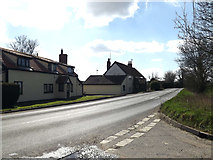
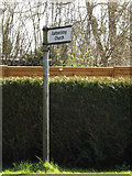
2 images in cluster Junction with Church Road B1078 Asbocking Road in TM1654
Image clustering - assigning images labels - is an automated process, based on the image title/description. It's not totally accurate, and can sometimes assign images to odd clusters
in TM1654, near Ashbocking, taken Friday, 25 March, 2016, by Geographer
Explore these images in the Browser or Explore matching images including in surrounding squares (if any!)
All images  © Geographer and licensed for reuse under this Creative Commons Licence
Other Automatic clusters in TM1654
- Church of All Saints Ashbocking
- B1078 Lower Road B1078 Ashbocking Road
- Near to Gosbeck
- Hemingstone Road Postbox
- Near Brewery Farm
- Sign
- Suffolk for more Info
- Tower
- South
- Village
- Saints Church Organ
- Saints Church Interior
- Saints Church Altar
- Roll of Honour
- Junction with Church Road B1078 Asbocking Road
- Glebe
- Footpath to Clay Lane
- East
- Window