Showing most recent first, in descending order
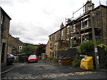
images in cluster Lane in Dobcross in SD9906
Image clustering - assigning images labels - is an automated process, based on the image title/description. It's not totally accurate, and can sometimes assign images to odd clusters
in SD9906, near Dobcross, taken Saturday, 5 October, 2013, by John Topping
Explore these images in the Browser or Explore matching images including in surrounding squares (if any!)
All images  © John Topping and licensed for reuse under this Creative Commons Licence
Other Automatic clusters in SD9906
- Lock on the Huddersfield Narrow Canal
- Railway
- Uppermill Viaduct
- Wool Road
- Dobcross Village
- Saddleworth Viaduct
- Dobcross Square
- High Street
- Uppermill Railway
- Diggle Flight
- Woods Lane
- Lock 25W
- Crosses
- Brownhill
- River Tame
- Mile Lock
- Transhipment
- Delph Donkey
- Mow Halls Lane
- Dobcross New Road
- Lock 23W
- Road Junction
- Lock 24W
- Cottage
- Old Milestone by the A670
- Path
- Limekiln Lock
- Elizabeth II Postbox
- Aqueduct
- Dungebooth Lock
- Highest Navigable Waterway in Britain
- Whit Friday Brass Band Contest
- Rushcart as an Annual Festival in 1975
- Passes Beneath
- BeerWalk has Reached its 34th Year
- Field
- Wider View
- Brownhill Bridge
- Pound between Locks 26W and 27W
- Followed on Sunday by the Yanks
- Farm Buildings Near