Showing most recent first, in descending order
5 images in cluster Liberty Lane in TQ0464
Image clustering - assigning images labels - is an automated process, based on the image title/description. It's not totally accurate, and can sometimes assign images to odd clusters
in TQ0464, near Addlestone
Explore these images in the Browser or Explore matching images including in surrounding squares (if any!)
Other Automatic clusters in TQ0464
- St Paul
- Church Road
- Grove
- Junction 11
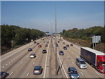
- Liberty Lane
- M25 Clockwise
- Simplemarsh Road
- Spinney Hill Bridge
- B3121
- Anti-clockwise
- Gantry
- Queens Arms
- Sayes Court Farm Drive
- Public House
- Near
- Little
- Lime Grove
- Holly Tree
- Coronation
- Church Road Bridge
- Area
- Wall