Showing most recent first, in descending order
images in cluster Littleborough in SD9418
Image clustering - assigning images labels - is an automated process, based on the image title/description. It's not totally accurate, and can sometimes assign images to odd clusters
in SD9418, near Littleborough/SD9316, taken Thursday, 28 January, 2010, by michael ely
Explore these images in the Browser or Explore matching images including in surrounding squares (if any!)
All images  © michael ely and licensed for reuse under this Creative Commons Licence
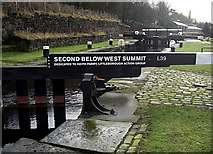
Other Automatic clusters in SD9418
- Near
- Punchbowl Lock
- Near Summit
- Railway Tunnel
- Pennine Bridleway
- Lock 38
- Western
- Calderbrook Road
- Chelburn Reservoir
- Punchbowl Lock 40
- St James Church
- Sign
- Lock no 41 Rochdale Canal
- Lock no 39 Rochdale Canal
- River Roch Aqueduct
- West Summit Lock no 37
- Rock Nook
- Sowerby Bridge
- Brickworks Quarry
- Estate
- Pound
- Saint James Calderbrook
- Towpath
- Pub
- Mary Towneley Loop
- Littleborough and Walsden
- Lower Calderbrook
- New Housing
- Chapel
- West Bank
- Trout Farm
- Timbercliffe Estate
- Large Old Mill Lies in both SD9418
- High into the Air through Ventilation Shafts
- Infant
- Rock-faced Stone
- Sladen Wood Mill