Showing most recent first, in descending order
images in cluster Looking in SE3131
Image clustering - assigning images labels - is an automated process, based on the image title/description. It's not totally accurate, and can sometimes assign images to odd clusters
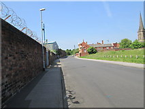
in SE3131, near Hunslet, taken Friday, 7 June, 2013, by Betty Longbottom
Explore these images in the Browser or Explore matching images including in surrounding squares (if any!)
All images  © Betty Longbottom and licensed for reuse under this Creative Commons Licence
Other Automatic clusters in SE3131
- Hunslet Road
- Low Road
- Balm Road
- River Aire
- Church Street
- Garden Gate
- Knostrop Cut
- St Mary's Church
- Midland Road
- Aire and Calder Navigation
- Knostrop Bridge
- Footpath
- National
- Gibraltar Island Road
- Old Mill Lane
- House
- Hunslet Freightliner Depot
- Approach
- Thwaite Gate
- Knostrop Flood Lock
- Penny Hill
- Hunslet Methodist Church
- Pepper Lane
- Sussex Avenue
- Joseph Street
- Car
- St Mary the Virgin
- Shop
- Playing Fields
- Whitfield Way
- Plant
- Mecca Bingo
- Branch
- Electricity Substation
- City Centre
- Baptist Tabernacle
- Balmoral Chase off New Pepper Road
- Viewed from Stafford Street
- Viewed from Severn Road
- Transpennine Trail Diversion
- Cat
- Hemingway Garth
- Looking North
- Primary School