Showing most recent first, in descending order
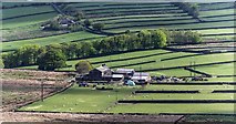
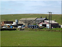
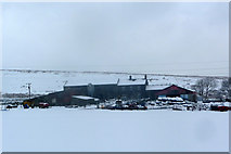
3 images in cluster Lower Rough Head in SD9825
Image clustering - assigning images labels - is an automated process, based on the image title/description. It's not totally accurate, and can sometimes assign images to odd clusters
in SD9825, near Hebden Bridge
Explore these images in the Browser or Explore matching images including in surrounding squares (if any!)
Other Automatic clusters in SD9825
- Whittaker Road
- Kilnshaw Lane
- Rake Head
- Lower Rough Head Farm
- Pennine Way
- Bridleway along the Edge of Erringden Moor
- Field
- Near
- Walls
- Track
- Stoodley Pike from Whittaker Road
- Pinnacle Lane
- Top of Whittaker Road
- Public Footpaths
- Kershaw Farm
- Disused Quarry
- Stile
- Horse
- Landcover: Acid grassland
- Line
- Top of Beaumont Clough
- Haylage
- National Trail
- Edge end Plantation