Showing most recent first, in descending order
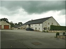
7 images in cluster Lower Standen in SD7340
Image clustering - assigning images labels - is an automated process, based on the image title/description. It's not totally accurate, and can sometimes assign images to odd clusters
in SD7340, near Clitheroe/SD7441
Explore these images in the Browser or Explore matching images including in surrounding squares (if any!)
Other Automatic clusters in SD7340
- Cotton Mill and Government Storage Unit
- Stalwart Carpet Works
- Primrose Road
- Primrose Lodge
- A671
- Commercial Mill
- Lower Standen
- Whalley Road
- Mill Demolished
- Clitheroe and Whalley
- Mearley Brook
- Remains of Commercial Mill
- Roof Lights
- Demolished to make Way for Housing
- Pendleton Brook
- Wall
- Flows
- Mill Dam
- Woone Lane
- Built
- Track Leading
- Clitheroe Sewage Works
- Old Industrial Area
- Offices
- Footpath to Henthorn Road