Showing most recent first, in descending order
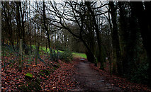
images in cluster Manor Park in SK0394
Image clustering - assigning images labels - is an automated process, based on the image title/description. It's not totally accurate, and can sometimes assign images to odd clusters
in SK0394, near Glossop, taken Tuesday, 15 December, 2015, by Chris Heaton
Explore these images in the Browser or Explore matching images including in surrounding squares (if any!)
All images  © Chris Heaton and licensed for reuse under this Creative Commons Licence
Other Automatic clusters in SK0394
- Glossop Station
- Norfolk Street
- Town
- North
- High Street West
- Fauvel Road
- Woodhead Road
- High Street East
- Talbot Road
- A57
- Closed
- Wall
- Arundel Street
- B6105
- Entrance
- George Hotel
- Looking South
- Service
- Howard Park
- Glossop War Memorial
- Manchester Piccadilly
- Platform
- Ashton-Under-Lyne Manchester Railway
- Moon Sixpence
- Howard Arms
- Clock
- Spire Hollin
- Corner Cupboard
- Public House
- St Lukes C of E Church
- Conservative Club
- NatWest Bank
- Avenue
- Way Junction
- Liberal Hall
- Saints RC Church
- Brook
- Early 1840s the Route Chosen Bypassed Glossop
- Coffee Shop
- Duck
- Heritage Centre
- Bottle Garden
- Post Office
- Co-op Department
- Originally the Wesleyan Reform Chapel Sunday School
- Electrification of the Line in 1954 Meant
- King Edward Avenue
- Partington Players Theatre