Showing most recent first, in descending order
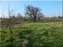
images in cluster Meets in NS3977
Image clustering - assigning images labels - is an automated process, based on the image title/description. It's not totally accurate, and can sometimes assign images to odd clusters
in NS3977, near Dumbarton, taken Friday, 19 April, 2019, by Lairich Rig
Explore these images in the Browser or Explore matching images including in surrounding squares (if any!)
All images  © Lairich Rig and licensed for reuse under this Creative Commons Licence
Other Automatic clusters in NS3977
- River Leven at Dalquhurn Point
- Opposite View
- Route
- Dalquhurn House
- Left of the Path
- Bottling and Blending Plant
- River Leven can be Seen
- Near the River Leven
- Slime Mould
- Housing Development
- Industrial Estate
- Mound 1470482
- Kilmalid Expansion
- Meets
- New Housing
- Blue Bridge
- British Species
- Track's Course
- Murroch Burn
- Howgate
- Work was Taking Place
- Wood beside a 2192687
- Area in the Foreground
- Strathleven Walk
- Stirling Road
- Leaf Galls
- Section of Cycle
- Existing Buildings
- Embankment in the Background
- Structures Sporangia
- Higher Ground
- Eastern Bank
- Kilmalid Farm
- Name Refers
- Walled Garden
- Boundary Fence
- Wooden Footbridge
- Close to 1751264
- Footpath to Dumbarton
- John Renton
- Detailed Description
- Common Alder
- Information Panels
- Alongside the Lade Intake
- Currently a Gate
- Beetle
- A82 Dual Carriageway
- Construction Process
- Nostoc Commune
- Comments on the Clearing
- Flood Defences
- Presence of Clinker