Showing most recent first, in descending order
4 images in cluster Neap High Water in NT6281
Image clustering - assigning images labels - is an automated process, based on the image title/description. It's not totally accurate, and can sometimes assign images to odd clusters
in NT6281, near Tyninghame, by Richard Webb
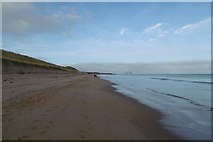
When: 11 March, 2018

When: 11 March, 2018

When: 11 March, 2018
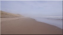
When: 10 December, 2016
Explore these images in the Browser or Explore matching images including in surrounding squares (if any!)
All images  © Richard Webb and licensed for reuse under this Creative Commons Licence
Other Automatic clusters in NT6281
- Brownrig Wood
- Bass Rock
- Sand Dunes
- East Lothian
- Lochhouses Links
- Ravensheugh Sands at Tyninghame
- Tide
- Road
- Tyninghame Beach
- High Dunes
- Coastal East Lothian
- Ravensheugh Woods
- Walk
- Neap High Water
- Path
- Ravensheugh Sands at Low Tide
- Cleared Buckthorn
- Sign
- Shelterbelts at Lochhouses Links
- St Baldred's Cradle
- Fog
- Burn
- View to Bass Rock in the Forth
- North Berwick Law
- Flooded Woodland
- Long Straight
- Looking Northwest
- Ravensheugh Log Cabin
- Northern Edge of Brownrig Wood