Showing most recent first, in descending order
images in cluster Near Aggborough in SO8275
Image clustering - assigning images labels - is an automated process, based on the image title/description. It's not totally accurate, and can sometimes assign images to odd clusters
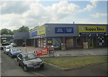
in SO8275, near Kidderminster, taken Monday, 17 May, 2010, by John Firth
Explore these images in the Browser or Explore matching images including in surrounding squares (if any!)
All images  © John Firth and licensed for reuse under this Creative Commons Licence
Other Automatic clusters in SO8275
- Brinton Park
- Falling Sands
- Caldwall Lock
- Stourport Road
- River Stour
- Watermill in Kidderminster
- Sutton Road
- Staffordshire and Worcestershire Canal Near
- Round Hill
- Carries the Severn Valley Railway
- Watermill Pub
- Crossing
- Early Triassic Sandstone of the Kidderminster Formation
- Park Lane
- Staffs Worcs Canal
- Falling Sands Bridge No 11
- 5ft 6in about 1 7 Metres
- Sign
- Caldwell Lock
- Public House
- Train
- Wrens Nest
- Round Hill Wharf
- Narrowboat
- Restaurant
- Senses Garden
- Structure is a Shelter
- Tennis Courts
- Aggborough and Foley Park Areas of Kidderminster
- Edge
- Snow
- Gates
- Paddling Pool
- Conversion to Residential
- Caldwall Bridge No 12
- Footpath
- Conveniently Located
- Santa Special
- Raveningham Hall
- Known Affectionately as the Flying Pig
- Bowling Green
- Cycleway and Path

