Showing most recent first, in descending order
4 images in cluster Nursling Rownhams in SU3816
Image clustering - assigning images labels - is an automated process, based on the image title/description. It's not totally accurate, and can sometimes assign images to odd clusters
in SU3816, near Lord's Hill/SU3815
Explore these images in the Browser or Explore matching images including in surrounding squares (if any!)
Other Automatic clusters in SU3816
- Bakers Drove
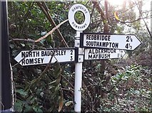
- Southampton
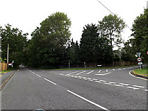
- Junction with the A3057 Romsey Road
- Redbridge Lane
- Pond
- Nutshalling Avenue
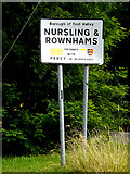
- Nursling Rownhams
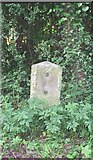
- Milestone Society National ID
- Way
- Lord's Hill
- Lake
- Ponds in the Area
- East side of Road
- Close