Showing most recent first, in descending order
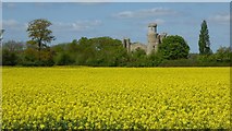
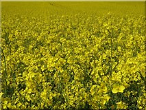
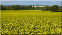
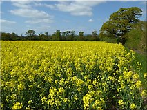
4 images in cluster Oilseed Rape in SO8842
Image clustering - assigning images labels - is an automated process, based on the image title/description. It's not totally accurate, and can sometimes assign images to odd clusters
in SO8842, near Dunstall Common, taken Saturday, 22 April, 2017, by Philip Halling
Explore these images in the Browser or Explore matching images including in surrounding squares (if any!)
All images  © Philip Halling and licensed for reuse under this Creative Commons Licence
Other Automatic clusters in SO8842
- 6th Earl of Coventry in 1766
- Malvern Hills
- Road across Dunstall Common
- M5 Motorway
- Bridge over the M5
- Croome Court
- House
- Panorama Tower
- Dunstall Farm
- Croome Estate
- National Trust along with the Nearby Follies
- Road Crossing Dunstall Common
- Adam was Paid 5 for the Drawing
- Oak Tree
- Restored Turret
- South
- Red Deer Farm
- Buttercups
- Floodwater
- Top of Dunstall Castle
- Oilseed Rape Field
- Sign
- Snow Covered
- Northbound
- North of Strensham Services
- Viewed from a Footpath
- Approaching
- Flooded
- Evening
- A4104 Pershore to Upton
- Closed
- Travellers
- Trunk of a Felled Oak Tree
- Barn Conversion
- Buttercups and Ox-eye Daisies
- Christmas Day
- Emerged from the Scaffolding
- Paired Arched Panels
- M5 Southbound