Showing most recent first, in descending order
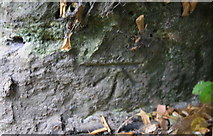
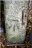
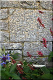
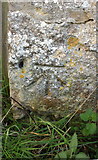
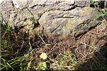
5 images in cluster Ordnance Survey Cut Mark Benchmark Described in SP4504
Image clustering - assigning images labels - is an automated process, based on the image title/description. It's not totally accurate, and can sometimes assign images to odd clusters
in SP4504, near Cumnor, by Roger Templeman
When: 19 October, 2015
When: 9 October, 2015
When: 9 October, 2015
When: 9 October, 2015
When: 9 October, 2015
Explore these images in the Browser or Explore matching images including in surrounding squares (if any!)
All images  © Roger Templeman and licensed for reuse under this Creative Commons Licence
Other Automatic clusters in SP4504
- Bear Ragged Staff
- Village Pond in Cumnor
- Ordnance Survey Cut Mark Benchmark Described
- High Street
- Tumbledown Hill
- Cumnor Village Hall
- House
- Church
- Leys Farm
- Upper Whitley Farm
- Looking
- Appleton Road
- Farmoor Reservoir
- New Farm
- Field Entrance from Cumnor
- Late October 2020