Showing most recent first, in descending order
images in cluster Phone Box in SZ0895
Image clustering - assigning images labels - is an automated process, based on the image title/description. It's not totally accurate, and can sometimes assign images to odd clusters
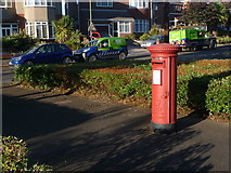
in SZ0895, near Northbourne/SZ0895, taken Friday, 26 July, 2013, by Chris Downer
Explore these images in the Browser or Explore matching images including in surrounding squares (if any!)
All images  © Chris Downer and licensed for reuse under this Creative Commons Licence
Other Automatic clusters in SZ0895
- Redhill Drive
- Redhill Common
- Headswell Avenue
- Sandy Way
- Moordown
- Path from Ahead
- Road Sign
- Grove
- Linear Wood
- Detached Houses
- Headswell Crescent
- Leybourne Avenue
- East
- Pine Vale Crescent
- Park Lane
- Red Hill
- Post Office
- Subway on Bridleway O14
- A347
- Footbridge
- Section of Wimborne Road
- Postbox BH10
- Standard Bournemouth Nameplate from the 1980s
- Jessopp Close
- Display
- Dead end of Georgian Way
- Nature Reserve
- Original main Course of the River
- Cover
- Parade of Shops
- Parish Church of St
- Aberdare Road
- Downhill
- Flag
- Zebra Crossing
- Justin Gardens
- Playing Field
- Pollarded Trees
- Part of Northbourne