Showing most recent first, in descending order
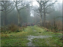
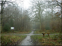
2 images in cluster Public Open Space Woodland in TQ3560
Image clustering - assigning images labels - is an automated process, based on the image title/description. It's not totally accurate, and can sometimes assign images to odd clusters
in TQ3560, near Warlingham, taken Sunday, 20 February, 2011, by Robin Webster
Explore these images in the Browser or Explore matching images including in surrounding squares (if any!)
All images  © Robin Webster and licensed for reuse under this Creative Commons Licence
Other Automatic clusters in TQ3560
- Mossyhill Shaw
- Kingswood Way
- Bridleway
- London Loop Path
- Ride
- London Loop Approaching Mossyhill Shaw
- Kingswood Lodge
- Kingswood Lane
- Footpath
- Covering around 150 Acres
- Field Edge Path
- Farleigh
- Public Open Space Woodland
- Beech Way