Showing most recent first, in descending order
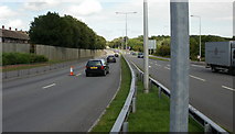
images in cluster Ringland Way in ST3487
Image clustering - assigning images labels - is an automated process, based on the image title/description. It's not totally accurate, and can sometimes assign images to odd clusters
in ST3487, near Liswerry, taken Thursday, 20 August, 2009, by Jaggery
Explore these images in the Browser or Explore matching images including in surrounding squares (if any!)
All images  © Jaggery and licensed for reuse under this Creative Commons Licence
Other Automatic clusters in ST3487
- Aberthaw Road
- Newport Retail Park
- Arthur Bliss Road
- Moorland Park
- Junction
- Viewed from the Corner
- Balfe Road
- Area of Newport
- A48 Southern Distributor Road
- Broadmead Park
- South Wales main Line Railway
- Path
- Speed Bumps
- Approach
- Houses on the North
- Seven Stiles Avenue
- Newport Bus
- Part of Newport
- South side of Aberthaw Road
- Langditch Lane
- Flats
- Liswerry Pill Reen
- Bungalows
- Perimeter Fence
- Warning Sign
- Penkin Hill
- Arthur Bliss Road Junction
- Alway Parade
- City Centre
- Clarks Shoe Shop
- Northern Edge
- Alongside the A48
- St Teilo's Church
- Vaughan Williams Drive
- Fallowfield Drive
- Boots
- Gibbons Close
- Greenmeadow Avenue
- Footbridge across Spytty Road
- Thompson Avenue
- New Look
- Electricity Substation
- Metres Diameter Roundabout
- Card Shop
- Near the Turning
- Business Units
- Service Yard
- Separate Infant and Junior Schools which Amalgamated
- Lliswerry Stores
- Matalan Clearance
- Llanwern Sports and Social Club
- Camera Prevent Vehicles using this Route
- Cul-de-sac on the West
- Pontfaen Fish Bar
- Pond is one of the Venues Used
- Ladyhill Green