Showing most recent first, in descending order
images in cluster Roman Catholic Church in NS3875
Image clustering - assigning images labels - is an automated process, based on the image title/description. It's not totally accurate, and can sometimes assign images to odd clusters
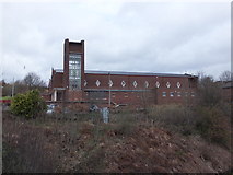
in NS3875, near Dumbarton, taken Thursday, 18 April, 2013, by Barbara Carr
Explore these images in the Browser or Explore matching images including in surrounding squares (if any!)
All images  © Barbara Carr and licensed for reuse under this Creative Commons Licence
Other Automatic clusters in NS3875
- Cardross Road
- Castle Hill
- Helenslee
- Castlehill Road
- Havoc Grassland
- A814
- Street
- Bruce's Flagstaff
- Talisman Avenue
- Cliffs at Brucehill
- Helenslee House Keil School
- Chapel of Convent of the Sisters
- Havoc Hole
- Demolition of the former OLSP
- Steps Leading
- Dumbarton Joint Hospital
- Shore Circular Path
- Railway Line
- Plaque
- South Wall of the Chapel
- Arthur's Seat
- Sea Cave
- Cunninghame Graham Memorial Park
- Eastern Entrance of the Park
- Lady and St Patrick's High School
- Path Continues
- Flats by the Renton Road
- St Michael's RC Church
- Flight of Steps
- Bruce's Stables
- Royal Fern
- Leven Valley Enterprise Centre
- Metalwork had been Removed