Showing most recent first, in descending order
2 images in cluster Russell in SE2028
Image clustering - assigning images labels - is an automated process, based on the image title/description. It's not totally accurate, and can sometimes assign images to odd clusters
in SE2028, near Birkenshaw/SE2028, by Betty Longbottom

When: 17 August, 2011
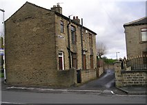
When: 31 October, 2008
Explore these images in the Browser or Explore matching images including in surrounding squares (if any!)
All images  © Betty Longbottom and licensed for reuse under this Creative Commons Licence
Other Automatic clusters in SE2028
- Bradford Road
- Old Lane
- St Paul's Church
- Whitehall Road East
- Station Lane
- Kirklees Way
- St Paul's Churchyard
- Mill Lane
- Navigation Bank
- A58
- Co-Op
- Birkenshaw Community Hall
- Gate
- Prospect Lane
- Town Street
- Birkhill Crescent
- National School
- Southcroft Avenue
- Hazel Close
- West
- Birkenshaw Industrial Society
- Royds Avenue
- Marsh Lane
- Brown Hill Drive
- Bowling Green
- Footpath Leading
- George
- Allen Croft
- Threshfield Crescent
- Viewed from Woodlands Fold
- Estate Agents
- Southfield Terrace
- Sherburn Grove
- Russell
- Post Office
- Manor House Spa
- Looking towards Bradford Road
- Court
- Ghyllroyd Avenue
- Methodist Chapel