Showing most recent first, in descending order
16 images in cluster Savile Town in SE2420
Image clustering - assigning images labels - is an automated process, based on the image title/description. It's not totally accurate, and can sometimes assign images to odd clusters
When: 29 January, 2006
By: Nigel Homer
Explore these images in the Browser or Explore matching images including in surrounding squares (if any!)
Other Automatic clusters in SE2420
- Savile Road
- River Calder
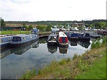
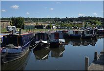
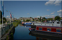
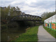
- Savile Town
- Headfield Road
- Warren Street
- South Street
- Thornhill Lees
- Looking
- Station
- Textile Mill
- Cleggford Bridge
- Bretton Street
- Holy Innocents Church
- Dewsbury Marina
- Hebble Navigation
- Caledonian Road
- Canal Basin
- Vicarage Road
- Selbourne Drive
- Orchard Street
- Park Road
- Cowper Street
- Wharf
- Viewed from Old Mill View
- Chapel Street
- Anchor House
- Electricity Substation
- Ground
- Hall
- Disused Railway Bridge
- Graveyard
- Thornfield
- Unit
- Cardwell Terrace
- Breedon Cement Plant
- Play Area