Showing most recent first, in descending order
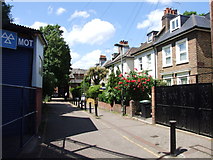
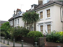
2 images in cluster Silk Mills Path in TQ3875
Image clustering - assigning images labels - is an automated process, based on the image title/description. It's not totally accurate, and can sometimes assign images to odd clusters
Explore these images in the Browser or Explore matching images including in surrounding squares (if any!)
Other Automatic clusters in TQ3875
- Ravensbourne River
- Quaggy River
- Lee High Road
- Lewisham Road
- Lewisham Centre
- Railway Station
- Lewisham High Street
- Shops
- Town Centre
- Cornmill Gardens
- Bridge
- Sign
- Loampit
- Quaggy River West of Lee High Road
- Clarendon Rise
- Molesworth Street
- Docklands Light Railway
- Entrance
- Flowing
- Roundabout
- A20
- Passes
- Info about the Gardens
- Car
- Office
- River Ravensbourne Near Engate Street
- Belmont Hill
- London SE13
- Market
- Clock Tower
- Hindu Temple
- Bus Station
- Eastdown Park
- Café
- Docklands Light Railway Terminus
- Anchor
- Stephen's Church
- Manager of World Class Auto Security
- Maggie's Restaurant
- Hayes Line
- Better Manage Increased Traffic Levels Associated
- Spire of former URC
- Standing on Platform
- Limes Grove
- Convent of the Sisters of St Andrew
- Looking Downstream
- View East
- Inter-war Building
- Greater London
- Open Space
- Silk Mills Path
- Edward VII Postbox
- Sensitive Instruments Disturbed by Trains
- Courthill Loop