Showing most recent first, in descending order
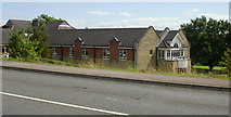
2 images in cluster St Cadoc's Hospital in ST3290
Image clustering - assigning images labels - is an automated process, based on the image title/description. It's not totally accurate, and can sometimes assign images to odd clusters
in ST3290, near Caerleon or Caerllion, taken Thursday, 27 August, 2009, by Jaggery

Explore these images in the Browser or Explore matching images including in surrounding squares (if any!)
All images  © Jaggery and licensed for reuse under this Creative Commons Licence
Other Automatic clusters in ST3290
- Roman Reach
- Pillmawr Road
- National Cycle Network Route 88
- Malpas to Caerleon Cycleway
- Lodge Road
- Cycle Route and Footpath from Malpas
- Line
- Farm Crescent
- Trinity View
- Near the River Usk
- Heads
- Railway Lines
- Railway Bridge
- Wentwood Road
- Signs at the Caerleon
- Viewed from National Cycle Network Route 88
- Farm Green
- Chestnut Grove
- Corner of Roman Reach
- Junction with Pillmawr Road
- Path from Chestnut Grove
- Flooded Field
- Tree Close
- Temporary Lake
- Broad Pill
- Walnut Drive
- Sharp Bend
- Path from the Glebelands
- Chichester Close
- Newport to Margam Country Park via Cardiff
- White Ash Glade
- Cutter Close
- Flying Scotsman Passing Caerleon
- Hazel Walk
- Track through Woods
- St Cadoc's Hospital
- Banner