Showing most recent first, in descending order
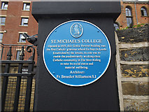
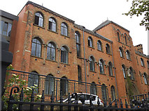
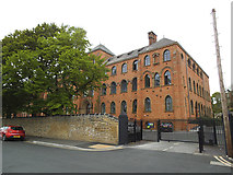
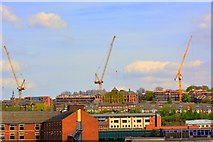
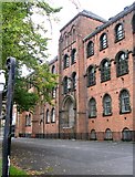
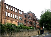
7 images in cluster St Michael's College in SE2834
Image clustering - assigning images labels - is an automated process, based on the image title/description. It's not totally accurate, and can sometimes assign images to odd clusters
in SE2834, near Leeds/SE3034
Explore these images in the Browser or Explore matching images including in surrounding squares (if any!)
Other Automatic clusters in SE2834
- Kirkstall Road
- Cardigan Road
- Woodsley Road
- Aire Place Mills
- Junction
- Thornville Street
- Benchmark Cut
- Triathlon Route
- Area
- Kirkstall Viaduct
- Thyssen Krupp
- Avenue
- Garden
- Burley Lodge
- Hyde Park Road
- ITV
- Moorland Road
- Years
- Burley Willows
- Victoria
- Part of Leeds
- Woodhouse Moor
- Ordnance Survey Cut Mark Benchmark Described
- Church
- Leeds University
- Liverpool Canal
- Harold Grove
- River Aire
- Bridge
- Student Accommodation
- Burley Lodge Terrace
- Royal Park Grove
- Railway Line
- Radio Aire
- Left Bank
- Car Park
- Cavendish Street
- Consort Terrace
- South side is Largely Clear of Buildings
- Hollis Place
- Fairbairn House
- Tiles
- St John's Avenue
- Bus Lane
- Grammar School
- North-east Facing Garden Wall of the Property
- Research Centre
- View of St
- Glass Factory
- Harold Walk
- Autumn Place
- Kelso Gardens
- Alexandra Grove
- Path Alongside
- Yorkshire Television Studios
- Belle Vue Lane
- Willow Approach
- Burley Willows Day Centre
- Charity Shop
- City Council
- Closed by 2008 974653 but has Reopened
- International Company whose Website Describes their Business
- Look Like
- Queen Victoria Stayed
- Opened in 2011