Showing most recent first, in descending order
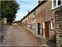
2 images in cluster Tolbury Lane in ST6734
Image clustering - assigning images labels - is an automated process, based on the image title/description. It's not totally accurate, and can sometimes assign images to odd clusters
in ST6734, near West End/ST6734
Explore these images in the Browser or Explore matching images including in surrounding squares (if any!)
Other Automatic clusters in ST6734
- Gants Mill
- Trendle Hill
- Cole Road
- Leland Trail
- Leggs Bridge
- Ordnance Survey Cut Mark Benchmark Described
- Shute Lane
- River Brue
- Tree
- Bruton Methodist Church
- Sexey's School
- Sign
- Tolbury Lane
- Board
- Leland Trail MacMillan Way
- High Street
- Grassy Field Hillside
- Chepstow House
- Brue Valley
- Wedding