Showing most recent first, in descending order
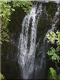
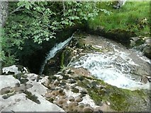
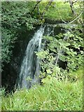
3 images in cluster Top of the Upper Fall in SD8367
Image clustering - assigning images labels - is an automated process, based on the image title/description. It's not totally accurate, and can sometimes assign images to odd clusters
in SD8367, near Stainforth/SD8267
Explore these images in the Browser or Explore matching images including in surrounding squares (if any!)
Other Automatic clusters in SD8367
- Catrigg Beck
- Catrigg Force Waterfall
- Path
- Scar
- Woods
- Cascades on Stainforth Beck
- Catrigg Foss
- Goat Scar Lane
- Lower Fall
- Path in the Catrigg Force Woodland
- Stone Wall
- Top of the Upper Fall
- Water
- Valley
- Track to Stainforth
- Mark the Position of Catrigg Force
- Rough Grazing Land
- Rain
- Pennine Bridleway