Showing most recent first, in descending order
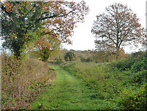
2 images in cluster Track in SU6662
Image clustering - assigning images labels - is an automated process, based on the image title/description. It's not totally accurate, and can sometimes assign images to odd clusters
in SU6662, near West End Green
Explore these images in the Browser or Explore matching images including in surrounding squares (if any!)
Other Automatic clusters in SU6662
- Farm
- Park Lane
- Devil's Highway Roman Road
- Mortimer Lane
- Butlers Land Farm
- Basingstoke to Reading
- Farmland
- Footpath towards Pitfield Lane
- Railway Bridge
- Byway
- Near
- Road from Calleva Silchester to London
- Woodland
- Viewed from Pier Road Bridge
- Track
- Stratfield Saye
- Approach
- Butlers Lands Copse
- Probably Created Artificially
- Known as the Devil's Highway
- Nelson Gate
- Accommodation Bridge