Showing most recent first, in descending order
images in cluster Trees in SO2827
Image clustering - assigning images labels - is an automated process, based on the image title/description. It's not totally accurate, and can sometimes assign images to odd clusters
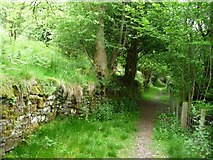
in SO2827, near Llanthony, taken Tuesday, 30 May, 2017, by Christine Johnstone
Explore these images in the Browser or Explore matching images including in surrounding squares (if any!)
All images  © Christine Johnstone and licensed for reuse under this Creative Commons Licence
Other Automatic clusters in SO2827
- Hotel at Llanthony
- View from Llanthony
- St David's Church at Llanthony
- Remains of Llanthony Priory
- Near Llanthony
- Ewyas at Llanthony
- Barn
- Road through Llanthony
- Llanthony Abbey
- Part of Llanthony Priory
- Nave
- Court Farm
- Arches
- Black Mountains
- Part of the Ruins
- Bar at Llanthony
- Cwm Bwchel
- House
- Car Park
- East
- Half Moon Hotel
- Farm Buildings
- Churchyard
- Pub
- Loxidge Tump
- Cwm-bwchel
- Llanddewi Nant Honddu
- Rooms
- Background and Church Cottage
- Hatterrall Ridge
- Ordnance Survey Cut Mark
- Horses
- Hatterrall Hill
- South Transept
- Grassy Bank
- Central Tower
- Looking East
- Public Footpath
- North Transept
- Perimeter Wall
- Camping site Entrance
- Warning Sign