Showing most recent first, in descending order
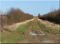
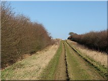
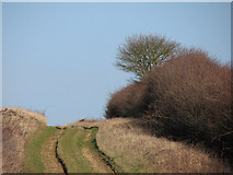
3 images in cluster Whitwell Farm in TL4056
Image clustering - assigning images labels - is an automated process, based on the image title/description. It's not totally accurate, and can sometimes assign images to odd clusters
in TL4056, near Barton/TL4055, taken Thursday, 8 March, 2012, by John Sutton
Explore these images in the Browser or Explore matching images including in surrounding squares (if any!)
All images  © John Sutton and licensed for reuse under this Creative Commons Licence
Other Automatic clusters in TL4056
- Barton Road Rifle Range
- Field
- B1046
- Military Firing Range
- Footpath
- Managed by Burwash Manor Farm
- Whitwell Farm
- Comberton Road
- Byway Near Barton
- Bench
- Danger
- Square
- Bales
- Interpretation Board
- Foxcotte
- Comberton Church
- Expansion of the Woodland Burial Ground
- Farmland