Showing most recent first, in descending order
2 images in cluster Wide Path in TQ4528
Image clustering - assigning images labels - is an automated process, based on the image title/description. It's not totally accurate, and can sometimes assign images to odd clusters
in TQ4528, near Duddleswell, by Marathon
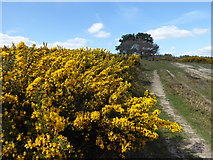
When: 10 April, 2017
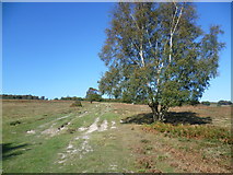
When: 15 October, 2011
Explore these images in the Browser or Explore matching images including in surrounding squares (if any!)
All images  © Marathon and licensed for reuse under this Creative Commons Licence
Other Automatic clusters in TQ4528
- Friends' Clump
- Crowborough Road
- Stonehill Car Park
- Path above the Misbourne Valley
- Highest Ridge of the High Weald
- Clump of Scots Pines
- Bracken
- View South
- Misbourne Valley to Stonehill Car Park
- Major Track
- Looking
- Lot of Trees
- Grazing
- Track Near
- Trees were Cut
- Cattle Grid
- Wide Path
- Woodland