Public Tags
Tag: 16th·Century·Building
Showing latest 50 of 68 images tagged with 16th Century Building tag.

|
The Ferry Boat Inn, North Fambridge, near Maldon
by Malc McDonald geograph for square TQ8596 The Ferry Boat Inn at North Fambridge in Essex. The inn dates from the 16th... (more)
Tags:
period:16th Century
16th Century
16th Century Building
top:Business, Retail, Services
county:Essex
type:Geograph
Grade II Listed Building
Grade II Listed Inn
subject:Inn
Inn
Listed Building
near:Maldon
place:North Fambridge
Public House
near:South Woodham Ferrers
|

|
Leicester Arms Hotel, Penshurst
by Malc McDonald geograph for square TQ5243 The Leicester Arms Hotel in the village of Penshurst, in Kent. It was built in... (more)
Tags:
16th Century
16th Century Building
top:Business, Retail, Services
near:Edenbridge
type:Geograph
Grade II Listed
Grade II Listed Building
county:Kent
Listed Building
place:Penshurst
near:Tunbridge Wells
subject:Village
top:Village, Rural Settlement
|
|
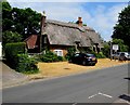
Thatched Cottage Hotel and Restaurant, Brockenhurst
by Jaggery geograph for square SU3002 Viewed across Brookley Road. The thatched building dates from the 16th century,... (more)
|
|
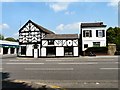
Joseph Mott House
by Gerald England geograph for square SJ9088 Joseph Mott House at 53 Buxton Road, Heaviley is a locally listed building.... (more)
|

|
Anne of Cleves' House, Southover High Street, Lewes
by Christopher Hilton geograph for square TQ4109 Tags:
period:16th Century
16th Century
16th Century Building
16th Century House
person:Anne of Cleves
type:Geograph
Heritage House
Historic House
top:Historic Sites and Artefacts
House
subject:House
top:Housing, Dwellings
Museum
Road
Street
|

|
Grade II (star) listed Buckingham Place, Brecon
by Jaggery geograph for square SO0428 Dating from the 16th century. An information plaque... (more)
Tags:
16th Century Building
top:City, Town Centre
type:Geograph
top:Historic Sites and Artefacts
top:Housing, Dwellings
|

|
Fickleshole, Surrey
by Malc McDonald geograph for square TQ3860 The hamlet of Fickleshole, on the North Downs. The building to the left of the... (more)
Tags:
16th Century
16th Century Building
Country Inn
place:Fickleshole
type:Geograph
Hamlet
subject:Hamlet
Inn
near:New Addington
North Downs
place:North Downs
Rural Hamlet
county:Surrey
top:Village, Rural Settlement
near:Warlingham
|

|
Butcher Row House and Folk Museum, Ledbury
by Jaggery geograph for square SO7137 Set back from the south side of Church Lane. An information plaque states that... (more)
|

|
The Tolsey House and Clock
by David Dixon geograph for square ST7593 The Tolsey House,at the corner of High Street and Market Street, with its well... (more)
|

|
Tolsey Museum, Burford
by Jaggery geograph for square SP2512 The High Street side of the Grade II (star) listed 16th century
rendered... (more)
|

|
The Barley Mow, near Wimborne Minster
by Malc McDonald geograph for square SU0302 The Barley Mow is a pub in Dorset countryside, near the town of Wimborne... (more)
Tags:
16th Century
16th Century Building
top:Business, Retail, Services
Country Pub
ceremonial county:Dorset
county:Dorset
time:Dusk
Dusk
type:Geograph
Minor Road
Minor Rural Road
Nightfall
Pub
Public House
subject:Public House
Rural Pub
Rural Road
Sky at Dusk
near:Wimborne
|

|
Bishop Hooper's Lodging
by Gerald England geograph for square SO8218
The Grade II* listed... (more)
|

|
The Old Manor, Finwood Road, Turner’s Green
by Robin Stott geograph for square SP1969 The building is set well back from the road and obscured by trees but a mildly... (more)
Tags:
16th Century Building
Arden
postcode district:CV35
type:Geograph
top:Housing, Dwellings
top:Lowlands
near:Rowington
place:Turners Green
top:Village, Rural Settlement
|
|
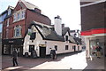
The Horse and Jockey, Wrexham
by Jeff Buck geograph for square SJ3350 The Horse and Jockey pub is one of the oldest buildings in Wrexham town centre,... (more)
Tags:
16th Century Building
top:Business, Retail, Services
top:City, Town Centre
top:Historic Sites and Artefacts
Pedestrianised Street
Pub
Pub and Restaurant
Public House
Thatched Building
country:Wales
place:Wrexham
county:Wrexham
|

|
Queen Mary's Bathhouse, Holyrood
by Jim Barton for square NT2674 A 16th century building, despite its name thought to have been a pavilion or... (more)
Tags:
16th Century Building
top:City, Town Centre
type:Cross Grid
place:Edinburgh
top:Historic Sites and Artefacts
|

|
Chaplain's Court (20 Chanonry)
by Bill Harrison for square NJ9408 The B-listed building... (more)
|

|
Greyhound Scene
by Gordon Griffiths geograph for square SO9496 The view by the Greyhound and Punchbowl Pub in Bilston High Street. The Grade... (more)
Tags:
16th Century Building
place:Bilston
place:Black Country
top:City, Town Centre
type:Geograph
High Street
High Street Pub
Public House
subject:Public House
Street Scene
West Midlands
|

|
Road junction and pub, Ringwood
by Malc McDonald geograph for square SU1604 The Elm Tree pub stands at a road junction in the town of Ringwood in Hampshire.... (more)
Tags:
16th Century Building
top:Business, Retail, Services
type:Geograph
county:Hampshire
top:Historic Sites and Artefacts
Pub
Public House
subject:Public House
place:Ringwood
Road Junction
top:Roads, Road Transport
top:Suburb, Urban Fringe
Thatched
Thatched Building
Thatched Pub
Thatched Roof
|

|
The Pentice on the High Street
by Steve Daniels geograph for square SU4829 The Pentice is a row of 16th Century colonnaded buildings on the High Street.
Tags:
16th Century Building
top:Business, Retail, Services
type:Geograph
top:Historic Sites and Artefacts
Pedestrianised Street
Shops
place:Winchester
|

|
Old Pub
by Gordon Griffiths geograph for square SO9496 The view of the Greyhound and Punchbowl in Bilston High Street. The Grade II*... (more)
Tags:
16th Century Building
Arson
place:Bilston
place:Black Country
top:Business, Retail, Services
type:Geograph
High Street
High Street Pub
subject:Public House
West Midlands
|

|
Burnt Pub
by Gordon Griffiths geograph for square SO9496 The view of the Greyhound and Punchbowl in Bilston High Street. The Grade II*... (more)
Tags:
16th Century Building
Arson
place:Bilston
place:Black Country
type:Geograph
High Street
High Street Pub
top:Historic Sites and Artefacts
subject:Public House
|

|
Evelaw and Evelaw Tower
by M J Richardson for square NT6652 A farm and a 16thC keep, the keep now in a ruinous state... (more)
Tags:
16th Century
16th Century Building
type:Cross Grid
Farm
Farm Buildings
top:Farm, Fishery, Market Gardening
Grass Fields
top:Grassland
Heather and Grass Moorland
Hillside
top:Housing, Dwellings
place:Lammermuir Hills
top:Roads, Road Transport
place:Scottish Borders
subject:Tower
top:Uplands
near:Westruther
top:Woodland, Forest
|

|
John Buchan Way in the Manor Valley
by Jim Barton geograph for square NT2137 The Way meets the minor road near The Glack farm. On the right is the old... (more)
|

|
Madeley Blue Plaque
by Gordon Griffiths for square SJ6905 The view of plaque at Madeley Court an 16th century manor house, the main... (more)
|

|
Court Lake
by Gordon Griffiths geograph for square SJ6905 The view in the grounds of Madeley Court an 16th century manor house, the main... (more)
|

|
Madeley Court Car Park View
by Gordon Griffiths geograph for square SJ6905 The view of Madeley Court an 16th century manor house, the main building is now a hotel.
|

|
Gate House
by Gordon Griffiths geograph for square SJ6905 The view of Madeley Court Gate House, the main 16th century manor house building... (more)
|

|
The Castle Bar
by Gordon Griffiths for square NY1230 The view of the 16th century building in Market Place, Cockermouth.
|

|
Kirkhope Tower, Ettrickbridge
by Jim Barton geograph for square NT3725 The tower is presumed to date from the 16th century and is a good example of a... (more)
Tags:
16th Century Building
Fortified Tower House
type:Geograph
top:Historic Sites and Artefacts
top:Housing, Dwellings
top:Moorland
Pele Tower
|
|
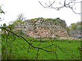
Wallace's Tower, Roxburgh
by Jim Barton geograph for square NT7030 The remains of a 16th-century tower house on the west bank of the River Teviot.... (more)
Tags:
16th Century Building
top:Derelict, Disused
top:Farm, Fishery, Market Gardening
Farmland
type:Geograph
top:Historic Sites and Artefacts
ruin:Tower House
|

|
Hirendean Castle
by Jim Barton geograph for square NT2951 In view is the highest part of the remaining ruin at the SW corner.
The ruins... (more)
|

|
North end of the Green, Long Melford
by Des Blenkinsopp geograph for square TL8646 Long Melford is aptly named, with the parish church of the Holy Trinity at the... (more)
Tags:
16th Century Building
Almshouses
type:Geograph
church:Holy Trinity
Village Green
top:Village, Rural Settlement
|

|
Elibank Tower
by Jim Barton geograph for square NT3936 The remains of a 16th century fortified tower. Access to the tower via the... (more)
|

|
Cowdenknowes House
by Jim Barton for square NT5737 A mansion and 16th century tower by the Leader Water. Further details can be... (more)
|

|
Barns Tower
by Jim Barton for square NT2139 A 16th century tower near to Barns House; further details are given on the... (more)
|

|
Golf course and Horsbrugh Castle
by Jim Barton for square NT2838 A low-lying point flooded on the Cardrona golf course with the ruined 16th... (more)
|

|
Covington Doocot and Tower
by Jim Barton geograph for square NS9739 The doocot is probably 16th century; it contained over 600 nesting boxes and the... (more)
Tags:
16th Century Building
Derelict Doocot
top:Derelict, Disused
ruin:Dovecot
type:Geograph
top:Historic Sites and Artefacts
Tower House (Ruin)
|

|
Cardrona Tower
by Jim Barton geograph for square NT3037 The Forestry Commission have thinned trees here to give a better view of this... (more)
Tags:
16th Century Building
type:Geograph
top:Historic Sites and Artefacts
Ruined Pele Tower
top:Woodland, Forest
|

|
16th Century Gatehouse, West Drayton
by Des Blenkinsopp geograph for square TQ0679 Entrance to a former manor house, the gatehouse has long outlived the manor... (more)
|

|
Hole in the Wall
by Gordon Griffiths geograph for square SJ4912 The view of the Pub on Shoplatch street in Shrewsbury. With records back to the... (more)
Tags:
16th Century Building
top:Business, Retail, Services
Pub
Public House
subject:Public House
place:Shrewsbury
|

|
Culross Palace
by Jim Barton geograph for square NS9885 The Palace is really a very large town house dating from the late 16th century,... (more)
|

|
Hertford town centre
by Malc McDonald geograph for square TL3212 Hertford is an historic market town. The Salisbury Arms Hotel in the centre of... (more)
Tags:
16th Century Building
top:City, Town Centre
place:Hertford
county:Hertfordshire
Historic Town
Hotel
|
|
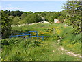
Madeley Footpath
by Gordon Griffiths geograph for square SJ6905 The view of the path alongside Madeley Court an 16th century manor house.
|

|
Parish Church of St Leonard, Walton-le-Dale
by David Dixon geograph for square SD5628 St Leonard's is a Grade II* listed building. Parts of the church, including... (more)
|

|
The Star Inn, Great Dunmow
by Malc McDonald geograph for square TL6222 The Star Inn is a 16th Century coaching inn in the town of Great Dunmow in... (more)
Tags:
16th Century Building
road:B Road
road:B1008
near:Bishops Stortford
top:Business, Retail, Services
top:City, Town Centre
Coaching Inn
county:Essex
type:Geograph
place:Great Dunmow
subject:Inn
Inn
|

|
Bankes Arms, Studland
by Malc McDonald geograph for square SZ0382 The Bankes Arms pub, in the village of Studland. The pub is believed to date... (more)
Tags:
16th Century Building
near:Bournemouth
top:Business, Retail, Services
county:Dorset
type:Geograph
place:Isle of Purbeck
Isle of Purbeck
near:Poole
subject:Public House
long distance path:South West Coast Path
South West Coast Path
path:South West Coast Path
ldp:South West Coast Path
place:Studland
near:Swanage
Village Pub
Village Public House
top:Village, Rural Settlement
|

|
Gawthorpe Hall Tower
by David Dixon for square SD8034 The Shuttleworth family motto : Prudentia et Justicia (Practical Judgement and... (more)
|

|
Gawthorpe Hall
by David Dixon geograph for square SD8034 Gawthorpe Hall is an Elizabethan house at the side of the River Calder, in... (more)
|

|
Gawthorpe Hall
by David Dixon geograph for square SD8034 Gawthorpe Hall is an Elizabethan house at the side of the River Calder, in... (more)
|
