Public Tags
Tag: 19th·Century·Housing
Showing latest 50 of 88 images tagged with 19th Century Housing tag.

|
Newland Street, Witham
by Christopher Hilton geograph for square TL8214 The town's high street, and the former line of the London-Yarmouth road.
|
|
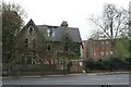
Concrete house, Dulwich Common
by Christopher Hilton geograph for square TQ3473 Category: House (derelict) This house is believed to be the only surviving 19th-century concrete house in... (more)
Tags:
19th Century
19th Century Building
19th Century House
building material:Concrete
Concrete
Concrete House
House
subject:House
ruin:House
top:Housing, Dwellings
Nineteenth Century
house:Victorian
Victorian House
|

|
St Peter's Church, Dulwich Common, and derelict house
by Christopher Hilton geograph for square TQ3473 Category: Church St Peter's is a former Church of England church, financed in part by the... (more)
Tags:
19th Century
19th Century Building
19th Century House
Church
church:Church of England (Former)
church:Church of England (Redundant)
building material:Concrete
Concrete
Concrete House
House
ruin:House
subject:House
Nineteenth Century
house:Victorian
Victorian House
|

|
Junction of Dalmally Road and Coniston Road, Addiscombe
by Christopher Hilton geograph for square TQ3466 This nineteenth-century development's location between two converging... (more)
|
|
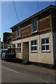
Victoria House, Easton, Freshwater
by Christopher Hilton for square SZ3486 |

|
Houses on Wellington Road, Nantwich
by Christopher Hilton geograph for square SJ6551 Tags:
period:19th Century
19th Century
19th Century Housing
top:City, Town Centre
type:Geograph
subject:Houses
Houses
top:Housing, Dwellings
Nineteenth Century
Road
housing:Semi Detached
housing:Semi Detached Houses
Semi Detached Houses
Semi-Detached
Semi-Detached Houses
Street
style:Victorian
era:Victorian
Victorian
period:Victorian
Victorian Architecture
Victorian House
Victorian Houses
|

|
Ellesmere: house off Market Street
by Christopher Hilton geograph for square SJ3934 Note, to the right, the sign urging social distancing during the Covid-19 epidemic.
|
|
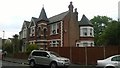
Castle-like house, Melfort Avenue, Thornton Heath
by Christopher Hilton geograph for square TQ3168 Tags:
19th Century
19th Century Building
19th Century House
subject:House
House
top:Housing, Dwellings
Victorian
house:Victorian
Victorian Building
Victorian House
|

|
Clonabreany House near Kells
by Rossographer geograph for square N6174 An early 19th century manor house, now restored and converted into a wedding... (more)
Tags:
19th Century House
19th Century Restoration
type:Geograph
top:Historic Sites and Artefacts
subject:House
former:Manor House
Manor House Site
top:Village, Rural Settlement
Wedding Venue
|

|
Main street in Wolsingham
by Robert Graham geograph for square NZ0737 Front Street, west of the market place. Newcombe House, in the centre here, is... (more)
Tags:
19th Century House
top:City, Town Centre
type:Geograph
top:Housing, Dwellings
Main Road Through Town
top:Roads, Road Transport
subject:Street
Town Centre Street
top:Wild Animals, Plants and Mushrooms
|

|
House for sale on Heathcote Road
by Jonathan Hutchins geograph for square SJ8049 A nineteenth-century cottage with three bedrooms, land and stables.
Tags:
period:19th Century
19th Century House
type:Geograph
place:Halmer End
subject:House
top:Housing, Dwellings
Nineteenth Century
top:Village, Rural Settlement
|

|
Coach House and Manor Tower, Oakworth from the front
by Stephen Craven geograph for square SE0338 According to Bradford Council's detailed appraisal of the Oakworth... (more)
Tags:
19th Century Housing
type:Geograph
top:Housing, Dwellings
Tower
top:Village, Rural Settlement
Workshop
|

|
Holylee House
by Jim Barton geograph for square NT3837 A 19th century country house in estate land by the Tweed east of Walkerburn,... (more)
Tags:
19th Century House
top:Country Estates
Country House
Estate
type:Geograph
top:Housing, Dwellings
top:Moorland
Woodland
top:Woodland, Forest
|
|
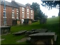
Ellesmere: houses on Church Street, from the churchyard
by Christopher Hilton geograph for square SJ4034 |
|
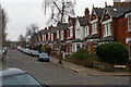
Dukes Avenue, Muswell Hill
by Christopher Hilton geograph for square TQ2989 |

|
Dawyck House from the Botanic Garden
by Jim Barton geograph for square NT1635 The 19th century house replaced a predecessor burnt down in 1830. The trees and... (more)
|

|
Manor Farm House and Barn
by Des Blenkinsopp geograph for square SO9847 An early 19th century house with a much older barn.
Tags:
19th Century House
type:Geograph
top:Housing, Dwellings
Timber Framed Barn
top:Village, Rural Settlement
|

|
B6296, Upper Town, Wolsingham
by Robert Graham geograph for square NZ0737 View looking north along the street, the main road north out of Wolsingham.... (more)
|
|
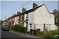
Houses on Castle View, Castletown Stafford
by Rod Grealish geograph for square SJ9123 A row of 19th century houses built at different times.
Tags:
19th Century Housing
road:Castle View
area:Castletown
type:Geograph
subject:Houses
top:Housing, Dwellings
postcode district:ST16
place:Stafford
county:Staffordshire
top:Suburb, Urban Fringe
|

|
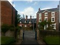
Fasganeoin House, Pitlochry
by Jim Barton geograph for square NN9457 The house was built in the second half of the 19th century for a presumably... (more)
Tags:
19th Century House
top:Business, Retail, Services
type:Geograph
Guest House
place:Pitlochry
top:Suburb, Urban Fringe
|
|
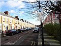
Ellesmere: houses on Church Street, from the churchyard
by Christopher Hilton geograph for square SJ4034 Tags:
19th Century Building
19th Century House
top:City, Town Centre
type:Geograph
subject:Houses
Houses
top:Housing, Dwellings
|
|
Sunbury Avenue, Jesmond
by Robert Graham geograph for square NZ2566 These long terraced streets in Jesmond were built in the late 19th century for... (more)
Tags:
19th Century Housing
type:Geograph
top:Housing, Dwellings
top:Rocks, Scree, Cliffs
top:Suburb, Urban Fringe
Suburban Housing
subject:Terrace (Housing)
Terraced Houses
|

|
Wood Green: cottages on Bounds Green Road
by Christopher Hilton geograph for square TQ3090 Tags:
19th Century House
19th Century Housing
Cottages
type:Geograph
subject:Houses
Houses
top:Housing, Dwellings
|
|
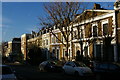
Leighton Road dropping towards Torriano Avenue
by Christopher Hilton geograph for square TQ2985 Tags:
19th Century House
19th Century Housing
top:City, Town Centre
type:Geograph
subject:Houses
Houses
top:Housing, Dwellings
top:Roads, Road Transport
Street
|

|
Junaidu Cottage, Lyme Regis
by Jaggery geograph for square SY3492 On the right at 55 Church Street, Junaidu Cottage is a Grade II listed 19th... (more)
Tags:
19th Century House
type:Geograph
Grade II Listed
top:Historic Sites and Artefacts
top:Housing, Dwellings
|

|
Hallmanor House, Manor Valley
by Jim Barton geograph for square NT2035 A 19th century house in an estate on the west side of the Manor Water. A brief... (more)
Tags:
19th Century House
top:Country Estates
Country House
type:Geograph
top:Park and Public Gardens
|

|
Grade II listed Sarn House, Hope, Flintshire
by Jaggery geograph for square SJ3058 Detached 19th century house on the corner of Hawarden Road and Sarn Lane.
|

|
Grade II listed number 70 High Street, Albrighton
by Jaggery geograph for square SJ8104 Built in the first half of the 19th century, the house has a central pedimental... (more)
|

|
Semi detached stone houses, Langtongate, Duns
by Graham Robson geograph for square NT7853 A pair of mid 19th century stone houses set back from the street on Langtongate.... (more)
|

|
St Woolos Road, Newport
by Robin Drayton geograph for square ST3087 Late 19th century terraced housing.
With the tower of Newport Civic Centre in... (more)
Tags:
19th Century Housing
top:City, Town Centre
type:Geograph
top:Housing, Dwellings
place:Newport
Steep Hill
housing:Terrace
|

|
Side road off Frankscroft, Peebles
by Jim Barton geograph for square NT2440 Stone houses in this area were built in the later 19th century.
Tags:
19th Century Housing
Cul De Sac Road
type:Geograph
top:Housing, Dwellings
place:Peebles
top:Suburb, Urban Fringe
|

|
Portmore House
by Jim Barton for square NT2548 The southern side of this mid-19th century mansion.
|

|
Cross Street, Peebles
by Jim Barton for square NT2540 Whinstone terraced houses built when textile mills were an expanding business... (more)
Tags:
19th Century Housing
top:City, Town Centre
type:Cross Grid
top:Housing, Dwellings
place:Peebles
Stone-Built Terraced Housing
|

|
Victorian letterbox set into house wall
by Martin Dawes for square TA1542 House is The Smithy early 19th century
Tags:
19th Century House
type:Close Look
top:Housing, Dwellings
top:Roads, Road Transport
Victorian Letterbox
top:Village, Rural Settlement
|

|
Estate houses in Lamington
by Jim Barton geograph for square NS9831 Part of the 19th century planned village that replaced the old settlement near... (more)
|

|
Planned estate houses, Lamington
by Jim Barton geograph for square NS9731 Mid-19th century houses built when the old cottages were replaced as a planned... (more)
|

|
Woodville, Lyme Regis
by Jaggery geograph for square SY3392 Steps lead up to the B3165 Silver Street side of Woodville on
the corner of... (more)
Tags:
19th Century House
road:B3165
Corner House
type:Geograph
Grade II Listed
top:Housing, Dwellings
top:Roads, Road Transport
top:Suburb, Urban Fringe
|

|
The Smithy early 19th century house
by Martin Dawes geograph for square TA1542 With Victorian letterbox set in its wall just before the more modern garages
|

|
Loch Shiel Hotel, Acharacle
by Jim Barton geograph for square NM6867 A late 19th century house, now a small hotel.
Tags:
19th Century House
top:Business, Retail, Services
type:Geograph
Hotel
top:Village, Rural Settlement
|

|
Berwick-Upon-Tweed Architecture : 1, 2 and 3 Wellington Terrace
by Richard West geograph for square NT9952 19th century. No.s 1&2 pre 1816; No.3 1852.
(source Charles Alexander... (more)
Tags:
19th Century House
top:City, Town Centre
top:Historic Sites and Artefacts
top:Housing, Dwellings
|

|
Brownber Hall
by Karl and Ali geograph for square NY7005 Category: 19th century building A Grade II listed building... (more)
Tags:
19th Century House
top:Housing, Dwellings
|

|
Norwood Grove
by Marathon geograph for square TQ3170 Until 1635, Norwood Grove formed part of the Great Streatham Common, which was... (more)
|

|
Church Close, Aldeburgh
by Christopher Hilton for square TM4657 The large nineteenth-century house on the left (now subdivided into several... (more)
|

|
Terraced cottages, Walkerburn
by Jim Barton geograph for square NT3537 A terraced row of stone cottages designed by the architect Frederick Thomas... (more)
|

|
Loaningdale House, Biggar
by Jim Barton geograph for square NT0438 People arriving at Loaningdale House to hear the concert pianist Angela Hewitt... (more)
Tags:
19th Century House
place:Biggar
type:Geograph
top:Historic Sites and Artefacts
Music Festival
top:People, Events
|

|
Farmhouse
by Bob Harvey geograph for square SJ7358 The wonderful tree and farmhouse at Hooterhall Farm
Tags:
period:19th Century
19th Century House
top:Farm, Fishery, Market Gardening
subject:Farmhouse
top:Lowlands
|

|
Glen House
by Jim Barton geograph for square NT2933 The Glen Estate's history dates back to the 13th century. The Scottish... (more)
|

|
Houses on Stuart Crescent, Wood Green, London N22
by Christopher Hilton geograph for square TQ3090 North of the centre of Wood Green there is green space either side of the High... (more)
|

|
Moses Gate Country Park
by David Dixon geograph for square SD7406 The house above the pond is Rock Hall. It was built in 1807 by the Crompton... (more)
|

|
Rock Hall
by David Dixon geograph for square SD7406 Category: Factory house (former) Rock Hall was built in 1807 by the Crompton family who owned the Farnworth Paper... (more)
|
