
|
Furzley Lane, Furzley, near Totton
by Malc McDonald
geograph for square SU2816
Furzley Lane is a minor road through the small hamlet of Furzley in the New... (more)
|
|
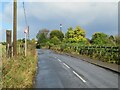
Birling Road, near Ryarsh
by Malc McDonald
geograph for square TQ6760
Birling Road is a minor road which links the villages of Birling and Ryarsh in... (more)
|

|
High Street, Shapwick, near Blandford Forum
by Malc McDonald
geograph for square ST9401
High Street is the main street through the small village of Shapwick in Dorset.... (more)
|

|
The A637 entering West Bretton
by Christine Johnstone
geograph for square SE2813
Traffic on the Huddersfield Road have to be reminded of the 30mph speed limit... (more)
|

|
The road to Warthill, heading north out of Holtby
by Christine Johnstone
geograph for square SE6754
The distant white 'gates' mark the end of the 30mph speed limit.
|

|
Judas Lane, heading north from Mellis Road
by Christine Johnstone
geograph for square TM1174
Restricted to 30mph? Chance would be a fine thing!
|

|
East End, near Furneux Pelham
by Malc McDonald
geograph for square TL4527
A minor lane passing through the small hamlet of East End, near the village of... (more)
|

|
Damaged car, Snowshill
by Derek Harper
geograph for square SP0934
|

|
Trevone Road
by Derek Harper
for square SW8975
|

|
B3314 at Bodieve
by Derek Harper
geograph for square SW9973
The road to Rock just west of the A39 crossing. Past the bus stops is a sign for... (more)
|

|
Junction, Broadway
by Derek Harper
geograph for square ST3115
Olivers Lane leaves Broadway Road, soon becoming a field access track with a... (more)
|

|
Ludwell Lane #8
by Derek Harper
geograph for square SX9491
|

|
Junction, Todber
by Derek Harper
geograph for square ST7920
The Hardy Way emerges from Shave Lane, on the right, and follows the main lane... (more)
|

|
Pottery Road, Horton
by Derek Harper
geograph for square ST3214
A village of straight roads, the five principal ones meeting at Five Dials, the... (more)
|

|
Grass triangle, Weston Lane
by Derek Harper
geograph for square SX8160
|

|
Junction on Weston Lane
by Derek Harper
geograph for square SX8160
Blackpost Lane turns off to the right.
|

|
Kingskerswell Road
by Derek Harper
for square SX9067
|

|
Granary and barn, West Bexington
by Derek Harper
geograph for square SY5386
Both buildings are listed; the C17 granary is described at... (more)
|
|
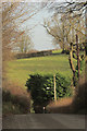
Bath Road
by Derek Harper
for square ST6657
By Withy Barn.
|

|
Ludwell Lane #6
by Derek Harper
geograph for square SX9491
|

|
Lane by Weare Wood
by Derek Harper
geograph for square SS4722
Passing a parking area.
|

|
Lane near Cheddon Fitzpaine
by Derek Harper
geograph for square ST2427
|
|
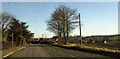
A659 in Collingham
by Derek Harper
geograph for square SE3745
|

|
Whithay Lane
by Derek Harper
geograph for square SY4596
This is the B3162 leaving Salway Ash (and the square), with a continuation of... (more)
|
